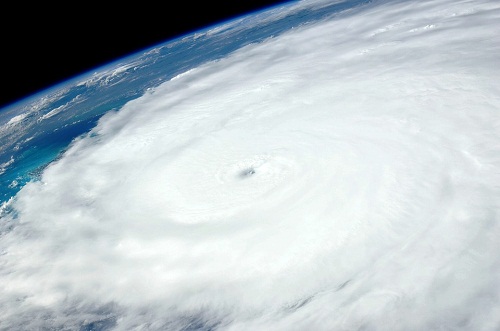
NASA’s Terra satellite has captured new images of Tropical Storm Daniel. These pictures were taken by the satellite’s Moderate Resolution Imaging Spectroradiometer or MODIS instrument on June 24 when the storm was off the west coast of Mexico.
According to NASA, the storm had degenerated into a remnant low pressure area by June 26.
The image showed a small, concentrated area of strong storms around the center of circulation with bands of thunderstorms feeding into the center.
Eastern Pacific -NASA Catches a View of a Fading Tropical Cyclone Daniel
Tropical Storm #Daniel was weakening when NASA’s Terra satellite passed overhead on June 24 and by June 26 the storm degenerated into a remnant low pressure area.https://t.co/iWa9Hbz1aP pic.twitter.com/SuKmnbBwOo— NASA Atmosphere (@NASAAtmosphere) June 26, 2018
At 11 a.m. EDT (1500 UTC) on June 26, the National Hurricane Center (NHC) issued the final advisory on Daniel. At that time, the center of Post-Tropical Cyclone Daniel was located near latitude 20.0 degrees north and longitude 120.2 degrees west. That’s about 690 miles (1,115 km) west-southwest
The post-tropical cyclone is moving toward the west-northwest near 9 mph (15 kph). NHC forecasters noted that a westward motion is expected to start later today. Maximum sustained winds are near 30 mph (45 kph) with higher gusts and is forecast to dissipate by Wednesday night, June 27.
NASA’s Terra satellite, launched in December, 1999, was designed to understand Earth’s climate and climate change by studying the connections between Earth’s atmosphere, land, snow and ice, ocean, and energy balance. The satellite also maps the impact of human activity and natural disasters on communities and ecosystems.
Terra is about the size of a small school bus (6.8 m long and 3.5 m across) and has five instruments onboard to take coincident measurements of the Earth system. These instruments are:
- Advanced Spaceborne Thermal Emission and Reflection Radiometer (ASTER)
- Moderate Resolution Imaging Spectroradiometer (MODIS)
- Multi-angle Imaging Spectroradiometer (MISR)
- Clouds and Earth’s Radiant Energy System (CERES)
- Measurements of Pollution in the Troposphere (MOPITT)

